


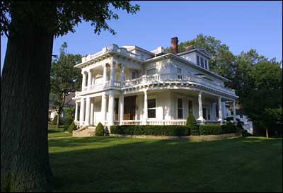
 Buckner House
Arrow Rock, Arrow Rock (10/15/66; NHL 5/23/63)
Arrow Rock Ferry Landing (Historic Resources of the Santa Fe Trail - Amendment), address restricted (5/01/13)
Arrow Rock State Historic Site Bridge (ECW Architecture in Missouri State Parks, 1933-1942 TR), southeast of Arrow Rock (3/04/85)
Arrow Rock State Historic Site Grave Shelter (ECW Architecture in Missouri State Parks, 1933-1942 TR), southeast of Arrow Rock (2/27/85)
Arrow Rock State Historic Site Lookout Shelter (ECW Architecture in Missouri State Parks, 1933-1942 TR), southeast of Arrow Rock (2/27/85)
Arrow Rock State Historic Site Open Shelter (ECW Architecture in Missouri State Parks, 1933-1942 TR), southeast of Arrow Rock (2/28/85)
Arrow Rock Tavern, Main Street, Arrow Rock (10/15/66; NHL 2/23/72)
Baity Hall, Missouri Valley College, 500 E. College, Marshall (6/25/86)
Bingham, George Caleb, House, First and High streets (10/15/66; NHL 12/21/65)
Blosser, Henry, House, east of Malta Bend off US 65 (12/29/78)
Buckner House, 125 N. Brunswick Ave., Marshall (4/19/84)
Chicago and Alton Depot, Sebree Street, Marshall (6/27/79)
First Christian Church, 400 Bridge St., Sweet Springs (9/12/80)
First Presbyterian Church (Rock Church), 212 E. North St., Marshall (9/20/77)
Fisher-Gabbert Archaeological Site, address restricted (3/16/72)
Fitzgibbon Hospital, 868 S. Brunswick Ave., Marshall (10/17/12)
Free Will Baptist Church of Pennytown, off MO UU 8 miles southeast of Marshall (4/19/88)
Gumbo Point Archaeological Site, address restricted (8/25/69)
Guthrey Archaeological Site, address restricted (12/02/70)
Mt. Carmel Historic District, 290th Road and MO Highway 41 North, Marshall vicinity (11/10/09; church destroyed by fire 5/1/2012)
Murrell, George A., House (Antebellum Resources of Johnson, Lafayette, Pettis, and Saline Counties, Missouri MPDF), 0.75 mile east and 0.5 mile north of MO E and H, Napton vicinity (11/14/97)
Neff Tavern Smokehouse, northeast of Napton off MO 41 and 6 miles west of Arrow Rock (11/30/78)
Old Fort, address restricted (1/13/72)
Plattner Archaeological Site, address restricted (3/04/71)
Saline County Courthouse, Courthouse Square, Marshall (8/24/77)
Santa Fe Trail - Grand Pass Trail Segments (Historic Resources of the Santa Fe Trail, 1821-1880 MPDF), junction of US 65 and Saline County Road T, Grand Pass vicinity (4/21/94)
Santa Fe Trail - Saline County Trail Segments (Historic Resources of the Santa Fe Trail, 1821-1880 MPDF), County Road 416 (Rural Route 3) west of junction with MO 41, Stanhope vicinity (6/30/94)
Sappington, William B., House, 3 miles southwest of Arrow Rock on TT (1/21/70)
Sweet Springs Historic District (Historic and Architectural Resouces of Sweet Springs, Saline County, MPDF; map) roughly along Lexington, Marshall, Miller and Spring streets, Sweet Springs (12/10/97)
Sweet Springs Historic District (Boundary Decrease; Historic and Architectural Resouces of Sweet Springs, Saline County, MPDF; map), 200-217 W. Lexington Ave. and 211 Marshall St., Sweet Springs (4/26/10)
Utz Site, Marshall vicinity (10/15/66; NHL 7/19/64; boundary revision 10/12/83)
Van Meter State Park Combination Building (ECW Architecture in Missouri State Parks, 1933-1942 TR), Marshall vicinity (2/27/85)
Van Meter State Park Shelter Building (ECW Architecture in Missouri State Parks, 1933-1942 TR), Marshall vicinity (2/28/85)
*Each bold-faced link in the list above leads to a word-searchable NATIONAL REGISTER NOMINATION for that resource; other links provide maps or additional context for the resource. The items may be downloaded (right-click) or viewed in your Web browser (double-click). File sizes range from 1 MB to several hundred MB, the time required for loading will depend on your connection speed. You may obtain a free copy of Adobe Reader software required to read the materials by visiting our Help page.