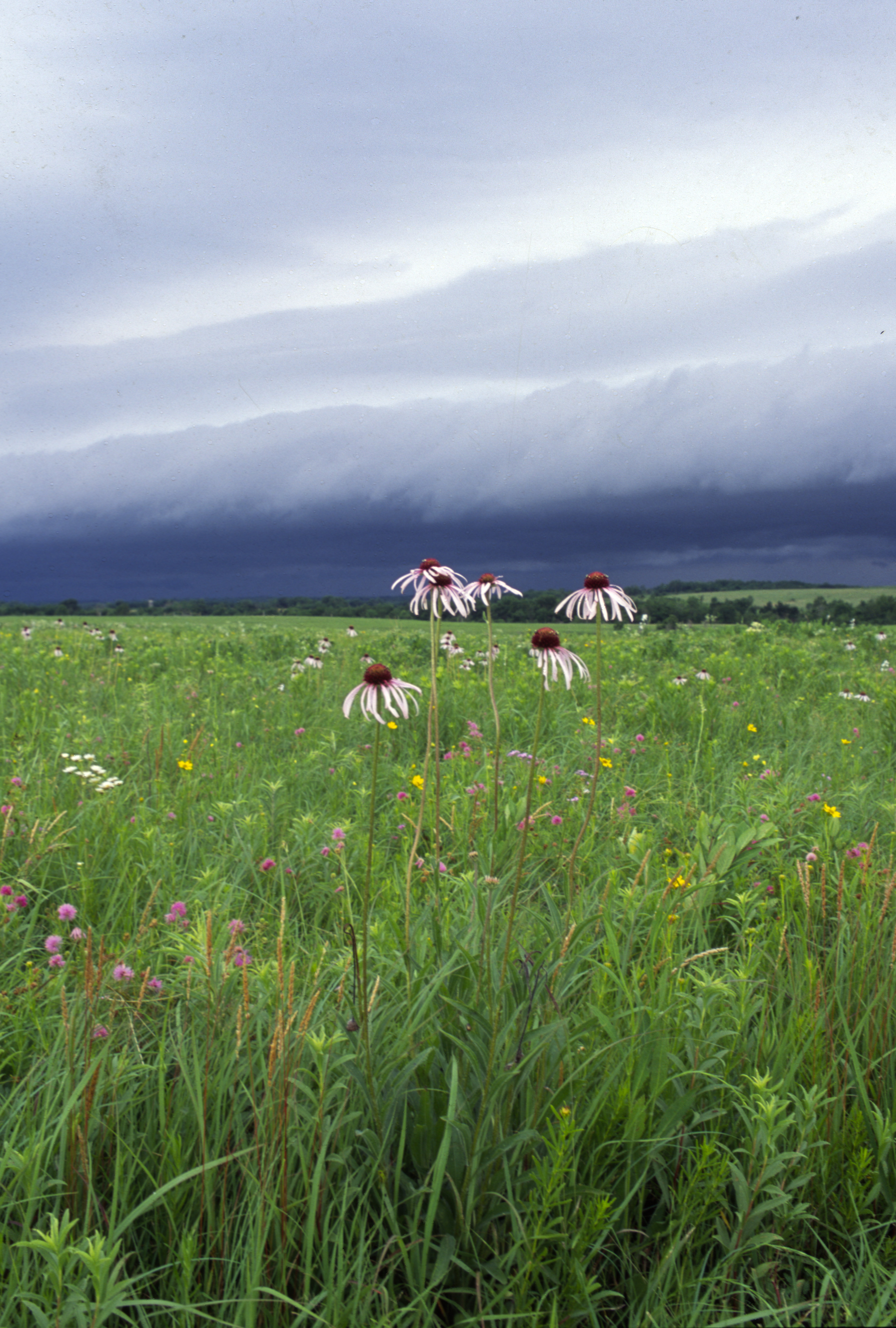
 Missouri has been blessed with an unusual diversity of native plants, animals and scenic areas. The state has some of the largest springs in North America and the second-greatest number of caves in the United States. There are tallgrass prairies, deep rich forests, barren glades and numerous crystal-clear streams. All these make for an unusually varied, beautiful and interesting natural history that has shaped Missouri's cultural history as well.
As you tour Missouri's state parks and historic sites, you will learn about our state's natural and cultural heritage. To ensure that special recognition and protection is afforded to some of the significant natural elements, certain areas have been designated as Missouri natural areas. Natural areas are managed and protected for their scientific, educational and historic values. They are formally recognized as the least disturbed and highest-quality biological and geological sites across the state.
Below are the publicly accessible natural areas located in Missouri State Parks properties. Please note that some of these areas extend beyond the boundaries of the state park.
Public Natural Areas in Missouri State Parks and Historic Sites
| Natural Area |
Location |
Total Acreage of Natural Area |
Notes |
| Bennett Spring Hanging Fen |
Bennett Spring State Park |
5 acres |
|
| Big Oak Tree |
Big Oak Tree State Park |
940 acres |
|
| Big Sugar Creek |
Cuivre River State Park |
56 acres |
|
| Botkins Pine Woods |
Hawn State Park |
30 acres |
|
| Chariton River Hills |
Long Branch State Park |
426 acres |
|
| Coakley Hollow Fen |
Lake of the Ozarks State Park |
1,776 acres |
|
| Coonville Creek |
St. Francois State Park |
49 acres |
|
| Des Moines River Ravines |
Battle of Athens State Historic Site |
40 acres |
|
| Elephant Rocks |
Elephant Rocks State Park |
7 acres |
|
| Elk River Breaks Woodland |
Big Sugar Creek State Park |
1,600 acres |
|
| George A. Hamilton Forest |
Cuivre River State Park |
40 acres |
|
| Graham Cave Glades |
Graham Cave State Park |
82 acres |
|
| Grand Gulf |
Grand Gulf State Park |
60 acres |
Owned by the L-A-D Foundation; managed by the Missouri Department of Natural Resources |
| Ha Ha Tonka Karst |
Ha Ha Tonka State Park |
70 acres |
|
| Ha Ha Tonka Oak Woodland |
Ha Ha Tonka State Park |
2,995 acres |
|
| Johnson's Shut-Ins |
Johnson's Shut-Ins State Park |
180 acres |
|
| Johnson's Shut-Ins Dolomite Glades |
Johnson's Shut-Ins State Park |
18 acres |
|
| Johnson's Shut-Ins Fens |
Johnson's Shut-Ins State Park |
8 acres |
|
| LaBarque Creek |
Don Robinson State Park |
1,966 acres |
Jointly owned and managed by the Missouri Department of Conservation and the Missouri Department of Natural Resources |
| LaMotte Sandstone Barrens |
Hawn State Park |
81 acres |
|
| Lincoln Hills |
Cuivre River State Park |
1,872 acres |
|
| Locust Creek |
Pershing State Park |
330 acres |
|
| Meramec Mosaic |
Meramec State Park |
831 acres |
|
| Meramec Upland Forest |
Meramec State Park |
461 acres |
|
| Montauk Upland Forest |
Montauk State Park |
40 acres |
|
| Mudlick Mountain |
Sam A. Baker State Park |
1,370 acres |
|
| Oumessourit |
Annie and Abel Van Meter State Park |
300 acres |
| Pickle Creek |
Hawn State Park |
58 acres |
|
| Pin Oak Slough |
Knob Noster State Park |
4 acres |
|
| Regal Tallgrass Prairie |
Prairie State Park |
3,646 acres |
|
| Roaring River Cove Hardwoods |
Roaring River State Park |
120 acres |
|
| St. Francois Mountains |
Taum Sauk Mountain State Park |
7,028 acres |
Jointly owned and managed by the Missouri Department of Natural Resources and the Missouri Department of Conservation |
| Stellata Natural Area |
St. Joe State Park |
2,077 acres |
|
| Vancill Hollow |
Trail of Tears State Park |
300 acres |
|
| Vilander Bluff |
Onondaga Cave State Park |
206 acres |
|
| Washington State Park Hardwood |
Washington State Park |
68 acres |
|
| SUMMARY |
36 Publicly Accessible MSP Natural Areas |
29,140 total acres |
|


