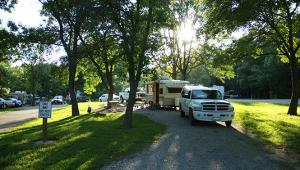
Van Meter State Park
- /sites/default/files/flickrcache/72157625850045959/5415702015.jpg
- /sites/default/files/flickrcache/72157625850045959/5415702455.jpg
- /sites/default/files/flickrcache/72157625850045959/5415702795.jpg
- /sites/default/files/flickrcache/72157625850045959/5415703291.jpg
- /sites/default/files/flickrcache/72157625850045959/5415704173.jpg
- /sites/default/files/flickrcache/72157625850045959/5416314880.jpg
- /sites/default/files/flickrcache/72157625850045959/5416315258.jpg
- /sites/default/files/flickrcache/72157625850045959/5416316096.jpg
- /sites/default/files/flickrcache/72157625850045959/5416316690.jpg
- /sites/default/files/flickrcache/72157625850045959/5416317600.jpg
- /sites/default/files/flickrcache/72157625850045959/5416317756.jpg
Activities
- camping
Basic and electric sites are available. Click here for more information.
- hiking
Seven hiking trails take you by both natural and cultural features of the park. Click here for more information.
- Interpretive Programs
Special programs and tours for groups may be arranged by calling the office in advance. Click here for a list of programs available.
- picnicking
Under lofty trees sit picnic sites, a playground and two picnic shelters. Click here for more information.
- fishing
Cast your line into the 18-acre Lake Wooldridge. Click here for more information.
- boating
You can launch canoes or small boats with paddles, oars or eletric trolling motors onto Lake Wooldridge, which is situated .25-mile down a trail.
- Playground
A playground is located in the picnic area.
Park information
Van Meter State Park features remnants of the Missouria Indian village that sat at the Great Bend of the Missouri River, marked on a map by Jacques Marquette and Louis Jolliet in 1673. A hand-dug earthwork -- Old Fort -- and several burial mounds lie within the park’s boundaries. The state’s Indian history is interpreted in displays and exhibits at the park’s Missouri’s American Indian Cultural Center. For outdoor enthusiasts, the park features hiking trails and an 18-acre fishing lake. The boardwalk that leads visitors through the Oumessourit Natural Area takes them over a freshwater marsh and fens, and through bottomland and upland forests. The park’s lofty trees shade picnic sites, picnic shelters and a campground.


