at Annie and Abel Van Meter State Park
Nature and Native Americans
 The high wooded hills and rolling farmlands that make up the landscape of Annie and Abel Van Meter State Park were once the homeland of the Missouri Indians. The state and its principal river derived their name from this tribe. Today, the park interprets both the landscape and the Native Americans who were its first occupants.
The area’s landscape was formed about a million years ago when melting glaciers sent water rushing into the rivers. Winds deposited a fine soil, called loess, on the hills that bordered the river bottoms. Gradual erosion of the loess-covered hills resulted in deep ravines and narrow ridges locally known as the Pinnacles. Less than 150 years ago, all except the lowest slopes were covered with tallgrass prairies.
For many centuries, Native American hunters traversed the Pinnacles and the nearby wetlands and prairies. The river, land and marshes were bountiful. Over long periods of time, these areas were scenes of encampments, a village site and earthen burial mounds. The prehistoric ancestors of the Missouri Indians, known to archaeologists as the Oneota, ascended the bluffs of the Missouri River and built their village on the summits of the Pinnacles. They occupied a 300-acre village site from 1450 to 1725, known as the Utz Site.
Diseases such as smallpox and cholera and warfare with other tribes devastated the Missouri population. Raids by the Sac and Fox tribe in the late 18th century forced the Missouri and their allies, the Little Osage, to leave the area. Explorer William Clark in 1804 noted that the Missouri "were once the most numerous nation in this part of the continent." By the time he wrote this, fewer than 400 Missouri remained and they were no longer an independent nation. Most had joined with the Otoes in Nebraska, but others joined with the Little Osage, Kansa and Ioway.
In 1673, French explorers Jacques Marquette and Louis Jolliet composed a map that located an “Oumessourit,” or Missouri Indian, village at the Great Bend of the Missouri River in what is now Saline County. The Missouri River played an important role in the lives of the Missouri Indians as they were able to control transportation on the river from their village overlooking the river bottoms. At its height, the village had a population of perhaps 5,000.
Disease and warfare took its toll. When the Little Osage Indians left the area in 1777, they left the Missouri without any allies, forcing them to join with the Otoes in Nebraska. By 1804, Meriwether Lewis and William Clark noted that the Missouri Indians were almost extinct.
In 1834, the family of Abraham and Elizabeth Vanmeter settled in the area of the park. (Historically, the family name was spelled as one word.) In 1932, “Miss Annie” Vanmeter deeded 369 acres to the state of Missouri in memory of her husband, Abel. In the 1930s, the Civilian Conservation Corps developed the park and built two shelter houses, which are still in use today.
 Today, a 300-acre natural area is preserved in the park. Oumessourit Natural Area features a freshwater marsh, fens and bottomland and upland forests reminiscent of those that occurred in the area in the 1600s. Several kinds of rare or uncommon plants and animals survive here, including marsh pondsnail, star duckweed and tufted loosestrife. Migrating birds are a common sight in spring and fall.
Hiking trails allow visitors to enjoy the park’s natural and cultural features. Three trails traverse near Lake Wooldridge, an 18-acre fishing lake in the park. Another takes visitors to two Native American sites known as the Old Fort, an earthwork located on a flat area of the Pinnacles, and the Mound Field, which is made up of three burial mounds that belonged to the Woodland Indians. This trail also winds up the Pinnacles and through part of Oumessourit Natural Area. Oumessourit Wetland Boardwalk Trail allows visitors to experience the wetland and bottomland forested areas of the natural area. Another short trail takes visitors to the Vanmeter (historical spelling) cemetery.
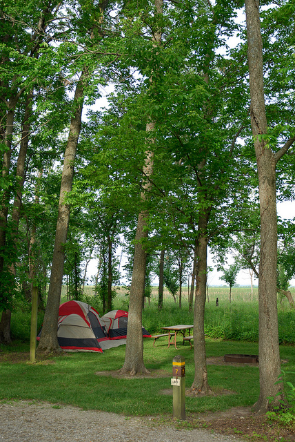
Under lofty trees sit picnic sites, a playground and two picnic shelters, which can be reserved, making the park a great place for large gatherings of family and friends. Overnight guests can stay in one of the basic or electric campsites. Modern restrooms and a showerhouse are located nearby.
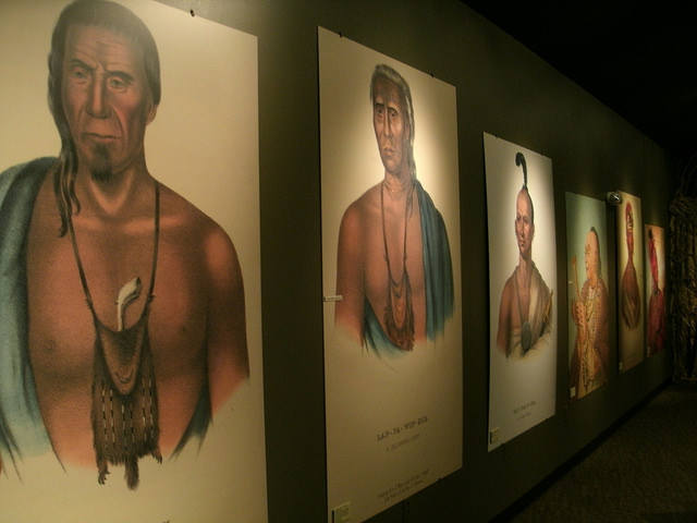
Missouri's American Indian Cultural Center, located in the park, interprets the homeland of the Missouri Indian tribe and other Missouri tribes and the park’s natural landscape through exhibits and a slide show. A large mural depicting the life of the Missouri Indians when they lived in the area more than 300 years ago is also on display. Special programs and tours for groups may be arranged by calling the office in advance.


