


at Clark's Hill/Norton State Historic Site
Retracing an Epic Journey
 In May 1804, Captains Meriwether Lewis and William Clark and the Corps of Discovery set out from the St. Louis area to explore the Louisiana Purchase territory. Since their journey, many people have retraced their route, carefully studying and researching their journals and looking for landmarks and landscapes mentioned.
A hill near Osage City in Cole County has been identified as one of those landmarks. Capt. Clark’s description of the hill helped historians pinpoint the actual hill itself. Between June 1 and 3, 1804, the expedition camped near the base of what is now known as Clark’s Hill. At that time, the Osage and Missouri rivers merged at this point. Clark ascended this hill to make observations about both rivers and noted them and the view in his journal.
“I measured the Osage & Missouris at this place made ther width as follows, the Missourie 875 yd. Wide The Osage R 397 yds. Wide, the distance between the 2 rivers 80 poles [16.5 feet] up is 40 ps... I assended the hill in the point 80 ps from the pt. Found it about 100 foot high, on the top is 2 graves, or mouns, a Delightfull prospect from this hill which Comds. [commands] Both rivers”
From the description given by Clark, visitors will find evidence of how much the area and the rivers have changed in the last 200 years. Clark viewed the confluence of the Osage and Missouri rivers from a rock on top of the hill. Today, from the same point, visitors can see the Missouri River to the left and the Osage River to the right. However, the rivers now merge together approximately 6 miles downstream near Bonnots Mill, making the view markedly different from what Clark saw. The measurements taken of the Missouri River also show that it was much wider in 1804 than it is today, mainly due to channelization.
Descriptions given in the Lewis and Clark journals also indicate that landscapes on each side of the Missouri River were quite different from what we observe today. These early explorers noted rich bottomland forests, open woodlands and shrub barrens and caves near Clark’s Hill. As they journeyed farther upstream, prairie became more common. Clark’s Hill, however, is still similar to what Clark saw in 1804. It consists mainly of limestone/dolomite woodlands, forest and cliff communities. In the 1980s, the amethyst shooting star, an imperiled plant and a relict species from a previous cooler climatic period, was discovered at the location.
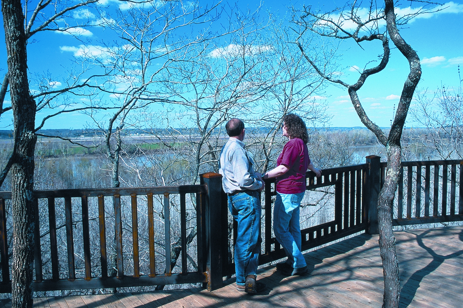
Just as William Clark did on June 2, 1804, visitors can journey through this wooded area to the top of Clark’s Hill and enjoy the view. Today, a trail and an overlook make it easier to reach the point where Clark once stood. The rock where Clark stood and the location of the crew’s campsite below along the banks of the Missouri River can be seen from the overlook.
On route to the overlook, the trail takes visitors past the two American Indian mounds that Clark wrote about in his journal along with three additional mounds discovered at the site. These mounds are burial mounds for high-status individuals, who, in their lifetime, gained the respect of the people in their band and were respected even in death. The size and shape of the mounds -- as well as the village site located nearby -- indicate that they probably date to the Late Woodland period (A.D. 600 to A.D. 900). Often, mounds like these were erected by hauling dirt from the village one basket at a time. Visitors are asked to respect these burial places and not climb on the mounds or disturb them in any way.
William and Carol Norton of Jefferson City donated the land that encompass the historic site to the Missouri Department of Natural Resources in 2002. The site opened in 2004 in time for the bicentennial of this epic journey, allowing visitors an opportunity to have an experience similar to that of Capt. Clark’s when he visited this location.