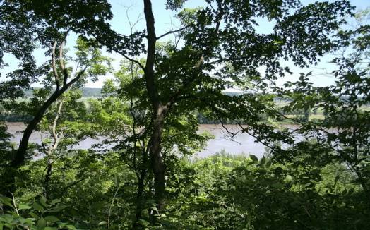
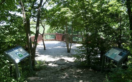
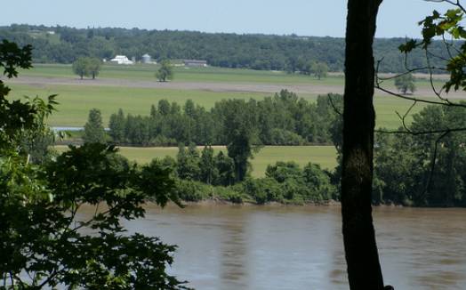
[Skip all navigation]

DNR Home PageDNR Home Page | Locator Map | Resource Center | FAQ | Events | Directory | Search

Clark's Hill/Norton State Historic Site
573-449-7402

Wayside exhibit near the overlook at Clark's Hill/Norton State Historic Site.

At a glance...

Osage City, MO


573-449-7402

Contact:  Rock Bridge Memorial State Park
Acreage: 13.40
Year Acquired: 2002
Activities: hiking - interpretive trail


High above the Missouri and Osage rivers, visitors to Clark's Hill/Norton State Historic Site can absorb the intriguing history of the hill, which will take them back to the epic journey of captains Meriwether Lewis and William Clark. On June 1-3, 1804, they camped at the base of what is now known as Clark's Hill.

Capt. Clark ascended the hill on June 2, 1804. His journals mention two Indian mounds he passed and the "delightful prospect" he had from the top, which included a view of the confluence of the Missouri and Osage rivers. He made observations and took measurements of the rivers from a rock on the hilltop.

Today, the two Indian mounds and three others lie along a half-mile wooded trail that takes visitors to an overlook of both rivers. However, the rivers now merge several miles downstream near Bonnots Mill. The rock where Clark stood and the location of the crew's campsite below can also be seen from the overlook. Interpretive signs along the trail discuss the history of the area.

The 13-acre site, donated to the state by William and Carol Norton, opened in 2004 in time for the bicentennial of the Lewis and Clark Expedition, allowing visitors to have a view similar to that of Capt. Clark's.

Click for Jefferson City, Missouri Forecast